Report
Many thanks to Lee Mathews for this report on the event organised by Sion Matthews.
Back to basics for this event. Relatively simple 30-mile route of open, fast roads in the middle of the Island, with all-but-one symbols placed very easy to see. This should ensure results would be close.
The event started from inside David Hughes Sports Hall, Menai Bridge, where a full entry of crews was signed-on by Endaf Davies. A number of new novice crews were competing, so even the straight-forward six figure map references needed some guidance from Sion. The ability to work out approaches and departs proved tricky for some, and “time management” is essential when plotting, by getting the route down on the map quickly, accurately and neatly.
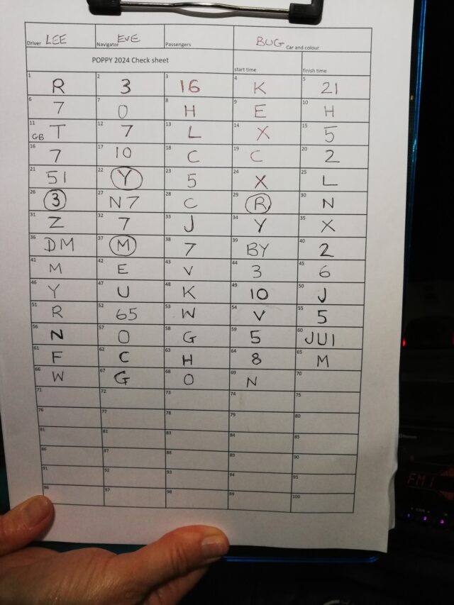
The first cars started to hunt for the 64 numberplate style symbols at about 19:30 hours down the yellow roads opposite the Mona Industrial Estate. A number of crews went the wrong way around the Cerrigceinwen loop, ending in a farmyard, whilst other wrong-plotted the approach and missed the loop completely.
The route then headed into Gwalchmai village and used the maze of streets here a different way to normal, proving to catch a few out, as the slots were very tricky to find in this direction, even Lee and Yvonne who were running course car and know these junctions well, overshot one turn.
North then through Carmel, looping through Llanerchymedd to take in the brilliant yellow road running from the middle of the village westbound. This road is not easy to find from the direction Sion had them approaching, and coupled with road-works traffic lights, patchy fog and mist, and the road covered in mud made it a memorable part of the route.
Into the middle of the island next, through Elim village and the multitude of yellow junctions that all look the same in that area, before heading south to the finish inside Tafarn yr Iorwerth in Bryngwran. It was on this final road that the only semi-hidden symbol was placed, in a gateway opposite a very easy to see one, just to take the eye away from the gateway. Only three crews spotted the “W”, which had been placed there to hopefully sort out potential ties, which did occur.
The faster nature of the route this time, no triangles and only one village street maze (Gwalchamai) meant everyone arrived well before 10pm, so no lateness penalties, and everyone swapping stories of wrong slots.
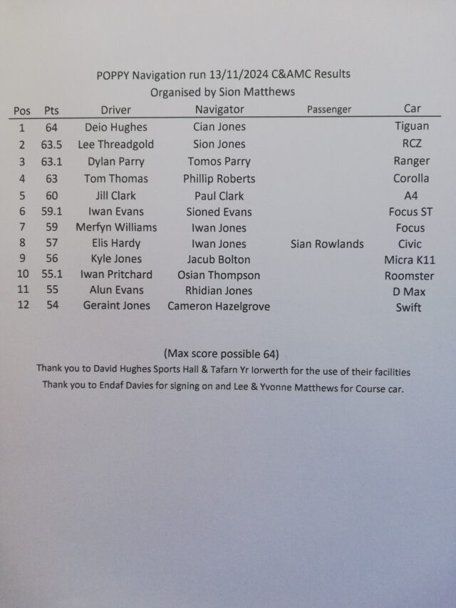
Results (see below) showed two crews spotted all 64 symbols, but Lee Threadgold and Sion Jones had mistaken a 'G' for a '6' so half a point was deducted, meaning they were bridesmaids to Deio Hughes and Cian Jones who recorded all the symbols correctly and won the event. Well done.
Third and fourth place also need a tie-break as they both only missed that gateway 'W' near the end. A symbol in Gwalchmai was 'T' but it included the 'GB' Great Britain logo on the cut-up number-plate digit, and as Dylan and Tomos had noted the 'GB' they were awarded third place ahead of Tom & Phil, who had not.
Jill and Paul were fifth having missed out some of the tricky loops through Gwalchmai village and missed three symbols there, whilst brother and sister crew, Iwan and Sioned went the wrong way or miss-plotted the final mile, missing the very last 4 symbols, ending on 59 points. Also on 59 points, losing the tie-break were Merfyn and Iwan who made the earlier and only error of missing most of the Gwalchmai village loops and five of the symbols there.
Along the way the route crossed over and along a number of ‘B’ classified roads which appear as brown on the map. The rules say symbols placed on A & B classified roads are duds, and there were four on this event. There are two reasons for this; the first to stop us driving slowly on roads other members of the public would not expect us to be going slowly along (looking for symbols), and the second is to check if the navigator is paying attention to the map and what colour road you are on. Some of the ‘B’ roads around Carmel do look like backroads when driving along them, but it’s up to the navigator to say “No symbols, it’s a B road”. None of the top seven crews made this error, but everyone else did, meaning a deduction of 1 point for each recorded. This widened the results gap, so Elis and Iwan’s 57 points could so easily have been 61.
On 56 points were Kyle and Jacob who, missed three symbols on a loop in Carmel. Rounding off the top 10 were Iwan and Osian in the Roomster on 55 points, winning the tie-break from Alun and Rhidian, as they missed the very first loop near Mona.
Finishing off the twelve entrants were the Suzuki Swift of Geraint and Cameron, who were just one point away from a top ten place. They appear to have gone the correct way but have missed the symbols that are very slightly obscured. Recording the duds did not help.
A very enjoyable event by Sion once again, and thank you to all the competitors for supporting the effort he and others put in. See you all at the next one.
Renew Your Membership
Current club membership cards expire on 31 October. You will need to renew your membership to enter the Poppy Navigation Run. Go to this link at Become A Member
Competitors should also have the RS Clubman Competition Licence, which is available free of charge at RS Clubman application
Information
This will be the third Navigation Run of the seasons and organised by Sion Matthews.
Navigation Runs are ideal for learning to plot a route and read a map, and provide good practice for anyone aspiring to compete in a road rally anytime soon.
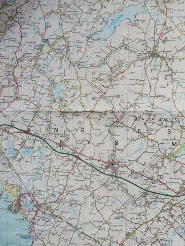
The start venue is the David Hughes Leisure Centre, Menai Bridge, LL59 5SS, at the rear of Ysgol David Hughes - Ordnance Survey map 114 (Anglesey/Ynys Môn), reference 547 723. what3words location ///airbase.prayers.germinate.
Sign on and route handouts at 19.00 hours. Finish at 22.00 hours.
You will require OS map 114(Anglesey/Ynys Môn), plus the usual navigation aids of poti, romer, pen/pencil, etc. Sign on from 19.00 hours; route handouts at 19.30 hours. .
Drivers and navigators need a valid club membership. Renew or join at Membership Application
